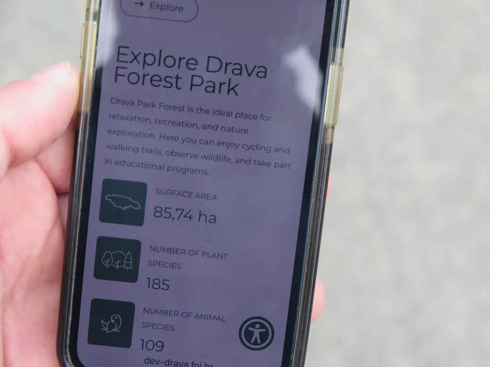
The digital platform being developed by the InterACT Green project in Varazdin promises to become an innovative tool for the co-management of the Drava Forest Park as well as for interactive communication between citizens, stakeholders and local authorities and a one-stop-shop to support visitors in better experiencing the forest and its ecosystem services. In this article we will explore the potential of the platform in supporting the provision and fruition of ecosystem services.
What do we mean for ecosystem services?
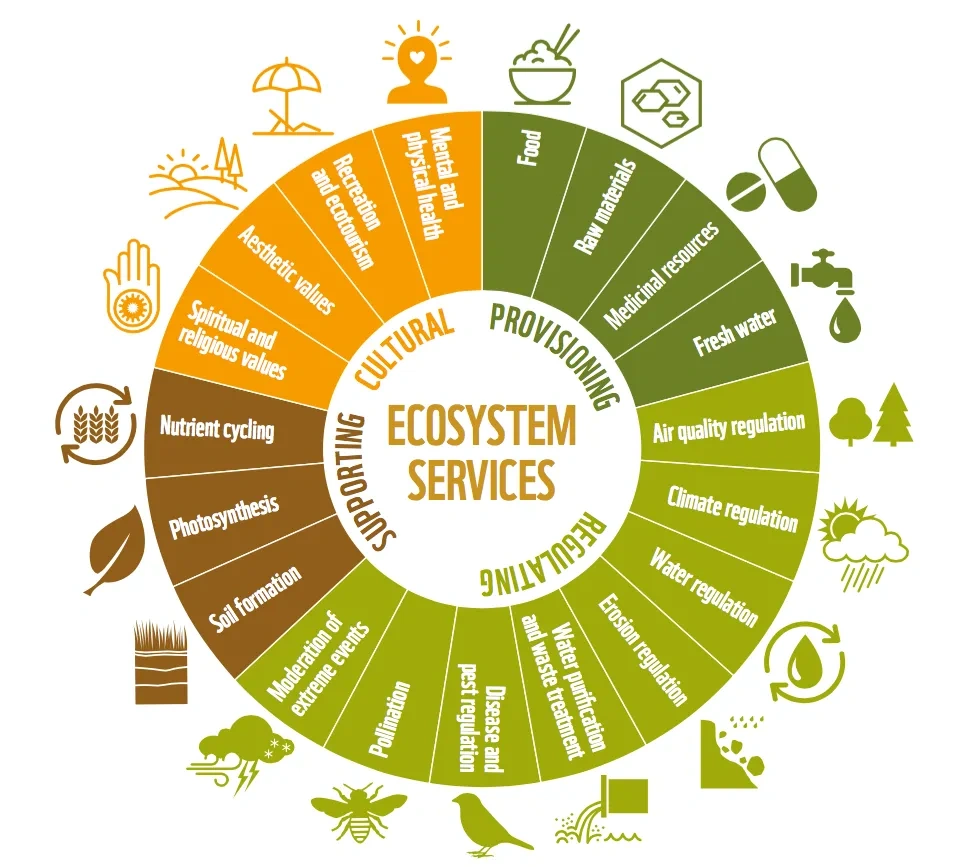
Following the official definition provided in the EUR-Lex Glossary, ecosystem services are the services that an ecosystem supplies and on which humans depend. In other words, ecosystem services are all the direct and indirect benefits that ecosystems provide to the people and their well-being. As the figure below illustrates, such benefits can be grouped in four categories:
- Provisioning of food, raw materials, medicinal resources, fresh water
- Regulating of air-quality, climate, water, pollination, extreme events mitigation, …
- Supporting soil formation, photosynthesis, nutrient cycling
- Cultural: aesthetic values, recreation and ecotourism, mental and physical health, spiritual and religious values.
The Drava Forest Park is the major provider of ecosystem services in Varazdin, and – as the preliminary results of a recent study1 by the Croatian Forest Research Institute (CFRI) show – its benefits extend to all four abovementioned categories.
___
1) The preliminary results of the study on “Ecosystem Services Provided by Drava Forest Park” were presented by Dr Martina Kičić (CFRI) during my site visit to Varazdin on 10 July 2025. The study served as a guide in the preparation of this entire article.
How can the PLATFORM come at hand?
In this section we will discuss how the PLATFORM canserve as a valuable tool supporting a better and more efficient management and fruition of the ecosystem services (ES) supplied by the Drava Forest Park
Mapping ecosystem services
First and foremost, it is crucial to be aware of what ecosystem services are available and where. Following Burkhard and Maes (2017),2 maps of ecosystem services may be used for multiple purposes, which include awareness raising, decision support, priority setting, ecosystem assessment, scientific spatial analysis, and more. Although it may seem rather obvious, the PLATFORM holds great potential in mapping and geolocating the sources of the various ES under each category. Currently, information and dataset are scattered across the different institutions that have jurisdiction over the forest. By scoping existing data, and possibly complementing with additional user input, the PLATFORM could be the ideal place to bring together all available information and generate a comprehensive and easily accessible GIS map of ES.
Assessing ecosystem services
Ecosystems are living and in continuous evolution, as environmental conditions are subject to change depending on both endogenous and exogenous variables. Regular monitoring and assessment of forest status – and thereby of the characteristics and trends of the ecosystem services it provides – are essential for efficient planning and management.
The assessment of ecosystem services is carried out through direct and indirect measurements, as well as user surveys. Direct measurements are site-based and involve qualitative assessments conducted by experts, based on direct observations or data from sensors located in strategic plots within the forest. Indirect measurements, by contrast, are typically GIS-based and primarily involve the analysis and interpretation of remote sensing data (e.g. satellite imagery), as well as modelling the provision of ecosystem services using tools such as InVEST (Integrated Valuation of Ecosystem Services and Tradeoffs), as in the study conducted by CFRI.
It is often the case that different entities conduct their own studies and assessments in parallel, each relying on their own databases and IT infrastructure. By becoming a hub that interconnects such datasets, studies, and assessments, the PLATFORM could serve as a major facilitator in the process, avoiding duplication of work while expanding the potential breadth and scope of assessments. Additionally, the PLATFORM could serve as the primary tool for conducting citizen and stakeholder surveys – on the one hand providing a unified channel for public outreach, and on the other ensuring that results are immediately accessible to all entities involved in forest management, not only to those directly responsible for the survey.
___
2) Burkhard B, Maes J (Eds.) (2017) Mapping Ecosystem Services. Pensoft Publishers, Sofia
How can the PLATFORM support ecosystem services in practice?
The preliminary study carried out by CFRI, highlighted the specific ecosystem services provided by the Drava Forest Park (DFP) under each of the four ES categories. This section offers a reflection on the potential practical use of such study and information through the PLATFORM.
Provisioning ecosystem service
The CFRI study recognises wood production as a potential provisioning ecosystem service (ES) offered by the DFP, while also acknowledging that – being a protected forest – felling is permitted only for sanitary reasons and not for commercial purposes. In this context, the PLATFORM could serve multiple functions, supporting both co-management efforts and public engagement. For example, it could enable:
- Public users to report and geolocate unhealthy trees, automatically notifying the relevant authorities responsible for intervention
- Near-real-time monitoring of vegetation health conditions, facilitating the planning of maintenance and felling operations
- Monitoring and forecasting of meteoric events that may compromise vegetation health, with automatic alert systems when necessary
- Geolocation of trees to be felled or removed, thereby supporting effective management and maintenance work
- Quantifying and assessing the amount of wood available and planning the next steps of its life-cycle (e.g., upcycling, sale/donation, disposal, …).
Regulating ecosystem service
The Drava Forest Park plays a substantial role, particularly in relation to the regulating ecosystem service. The CFRI identified carbon storage, climate regulation, flood risk mitigation, and erosion control as the main benefits provided by the forest. These ecosystem services are especially important both for the long-term planning and maintenance of the forest and for risk management and mitigation purposes. Through the PLATFORM, for example, it would be possible to:
- Monitor and forecast changes in ecosystem services in relation to vegetation health, broader natural dynamics, and exogenous factors, and generate alerts or early warnings related to deterioration risks
- Monitor environmental risks in real time and, when necessary, issue alerts and coordinate emergency responses as well as post-event maintenance interventions
- Assess the potential impact of local policies (e.g. land use, mobility, energy, etc.) on the forest and its ecosystem services
- Integrate climate and risk data into planning processes, supporting urban authorities in aligning development plans with ecosystem capacities and vulnerabilities
- Raise awareness and provide educational content to the public regarding the benefits of ecosystem services
- Provide information and alerts to the public in the event of severe climate phenomena (e.g. heatwaves, storms, floods)
- Share a list of environmental shelters, particularly in the case of extreme heat events.
Supporting ecosystem service
In respect to the supporting ecosystem service, the CFRI study chiefly focuses on biodiversity and major benefit brough about by the DFP. Merging all available information and datasets on local flora and fauna sourced from all relevant entities and stakeholders into the PLATFORM could bring substantial benefits on various levels:
- Map, tag, and geolocate the different species present in the forest to enable efficient monitoring and cross-referencing between the datasets of various entities
- Ensure that forest maintenance interventions are planned in accordance with the natural cycles of local fauna
- Allow reporting of injured animals with automated notification to the competent entities
- Provide informational and educational content on local flora and fauna to the public, potentially with location-specific notifications to inform visitors when they are in particularly valuable areas
- Offer a photo-recognition tool to help visitors identify species
Cultural ecosystem service
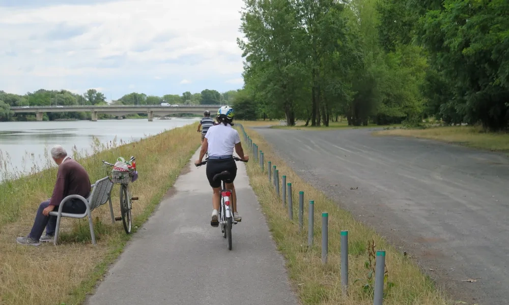
Lastly, the CFRI study recognises recreation as the primary benefit associated with cultural ecosystem services. In particular, paths, trails, and rest and leisure areas have strong potential to provide recreational value to forest users. Thanks to the PLATFORM, these benefits could be further enhanced and leveraged in various ways:
- Provide hiking and cycling itinerary recommendations tailored to users’ preferences, including integration via APIs with mainstream mapping and itinerary platforms such as Komoot and Strava
- Enable users to report the condition and assess the quality of trails and paths, contributing to a continuously updated live map, while also notifying the relevant authorities of any maintenance needs
- Issue live alerts regarding the status or closure of trails and paths, where applicable
- Allow real-time reporting of incidents or other emergencies, with immediate notification sent to first responders
Final remarks
The diversity of ecosystem services supplied by Drava Forest Park highlights the platform’s potential to enhance public awareness and support collaborative management. The platform’s capabilities extend beyond those outlined here, and the development team at FOI is incorporating many of these features for launch in the coming months.
What is important to highlight is how a well-planned, comprehensive tool such as the PLATFORM could bring together a wealth of data and information in a single place, fostering cooperation and co-management among multiple entities, while at the same time offering an easy-to-navigate and interactive experience for forest visitors – thereby maximising their enjoyment of the forest and the ecosystem services it provides.
By design, the PLATFORM’s architecture has been conceived as a highly flexible tool, with extensive options for customisation, offering the opportunity to tailor ad hoc versions according to the needs of any urban authority interested in adopting a similar approach. Hence, the PLATFORM promises to become a cutting-edge digital solution for green infrastructure co-management and public fruition, with a high potential for transfer and replication at European level.
About this resource


The European Urban Initiative is an essential tool of the urban dimension of Cohesion Policy for the 2021-2027 programming period. The initiative established by the European Union supports cities of all sizes, to build their capacity and knowledge, to support innovation and develop transferable and scalable innovative solutions to urban challenges of EU relevance.

Similar content