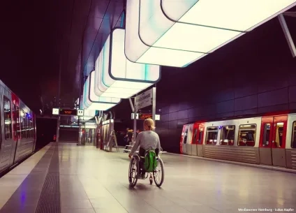
Making better decisions, faster, to tackle air pollution

AIR-HERITAGE in a nutshell
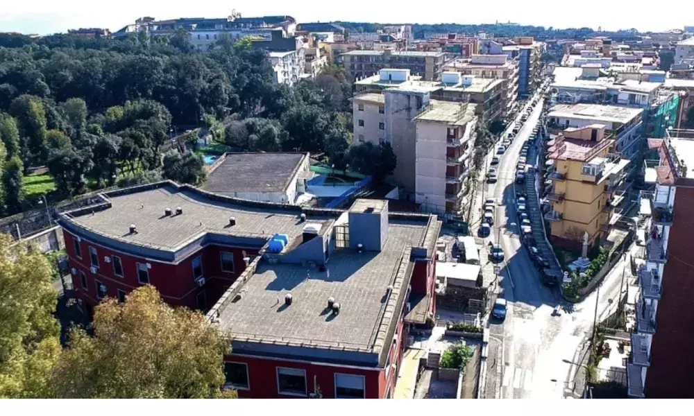
AIR-HERITAGE aims to design and implement effective, participative policies to improve the air quality in the City of Portici. As such, the project is developing a Decision Support System, the Urban Innovative Air Quality (UIAQ) tool, that makes use of monitored and modelled data, to assess current levels of air pollution in the city and inform the local policy making process.
The UIAQ smart tool for policy makers and citizens
The aim of the UIAQ tool is to help policy makers assess air quality in urban areas and put in place the most effective short-term policy response to address air pollution hotspots in the city. In addition, the tool also aims to inform citizens about air pollution in the city and help them monitor air quality levels as they move around the city (via GPS).
The innovative UIAQ tool integrates various real-time and forecasted data and information, as illustrated in the diagram below, including:
• Traffic data and modelled traffic scenarios; and
• Modelled and monitored air quality data.

The beta version of the UIAQ tool has been recently released, after about a year of development.[1] The city of Portici is currently testing the tool to identify key modifications needed, so that the tool can be further customised and improved to fully meet the municipality’s needs and expectations.
The different elements of the UIAQ tool are presented in detail below.
Traffic within the City of Portici has been modelled and forecasted using traffic simulation [2] This is used off-line (i.e. outside the UIAQ system).
A number of baseline traffic scenarios have been developed, based on actual traffic data, analysed over a period of a year, [3] to reflect variances in traffic during different seasons, days and hours. Initially, traffic flows have been determined for roads with traffic data, and subsequently traffic flows have been estimated for roads with no traffic data. Hence, for each typical day the simulation provides forecasted traffic and velocity data in each road per hour.
Furthermore, a number of policy reduction scenarios are currently being developed, including traffic control policies (such as diverting traffic or limiting the use of specific streets) and vehicle restriction measures (for instance, banning vehicles of a specific Euro emission standard, or of a specific fuel type such as diesel from driving in and through the city centre). The model subsequently calculates traffic and velocity data in each road per hour under each reduction measure (i.e. policy reduction scenario).
Therefore, traffic scenarios simulate traffic conditions each day, with and without reduction measures.
In order to estimate air quality emissions per traffic scenario, COPERT [4] has been used to compute emission factors, considering vehicle characteristics and when relevant the traffic/vehicle constraints introduced by the reduction measure.
Estimated emissions for both the baseline traffic scenario and the respective policy reduction scenarios are used in the air quality model to evaluate local air quality.

Typically, air quality models are steady-state dispersion models, incorporating a simplistic description of the dispersion process and approximating plume behaviour. As a result, some of the fundamental assumptions made do not accurately reflect reality. For example, when calculating hourly ground-level concentrations, air pollutants released during the previous hours are not considered. Another example is that these models usually assume a minimum wind speed, as they ‘break down’ during low wind speed or calm conditions.
In order to improve estimates of ground-level concentrations of air pollutants, a new “box” model was developed. [5] The new air quality model was developed using a process based modelling approach. This ensures that the model simulates the detailed physical and biological processes that explicitly describe air pollutants dispersion and removal. Furthermore, a Compartment Flow/System Dynamics approach has been employed. This enables conceptualising the system in terms of compartments (stocks) and flows (processes). From a modelling point of view, the main advantage of this approach is that the graphical representation of the system variables and processes helps the model development within an interdisciplinary workgroup. From a mathematical point of view, the use of differential equations means that the air pollutant concentrations calculated in each moment of time depend on concentrations calculated before, allowing for the accumulation of pollutants to be considered even in calm weather conditions.
In order to develop the model, the key elements and processes involved were identified. Experts from various scientific disciplines were consulted to determine which processes are fundamental to capture the dynamics of the system. In essence, the following processes have been incorporated into the model:
-
Dry deposition of pollutants on vertical surfaces. Consequently, the air quality model takes into account the contribution of plants and vegetation in removing air pollutants, in particular particulate matter;
-
Wet deposition (through precipitation, for example because of rain);
-
Simplified chemical reactions that air pollutants undergo;
-
Movement of pollutants by simple diffusion; and
-
Movement of pollutants due to wind/air masses.
The model also includes 3D wind flow calculations, which take into account the geometry of buildings, considering advection and turbulent flows, as well as horizontal and vertical flows.
In terms of input, the model uses:
-
Modelled emissions from local traffic
-
Meteorological data; and
-
Terrain and land use data (e.g. vegetation and buildings).
A key input to any air quality model is emissions of air pollutants. The model developed primarily considers traffic emissions (incorporated as line sources), as it has been assumed that air pollution in Portici is mainly from traffic. [6] However, Portici is the centre of an urban area within the Naples metropolitan area, thus there are other pollution sources within and outside Portici that affect local air quality. Consequently, urban accumulation and the regional background is also incorporated in the model. More specifically, data from the air quality monitoring stations are used to calibrate the model (with night measurements being the starting point of the simulation) in order to account for urban accumulation. The regional background is obtained from the Copernicus Atmosphere Monitoring Service (CAMS). [7]

Topography, land use and meteorology are important when determining the dispersion of air pollutants, their dry/wet deposition and removal by vegetation. Even more so for the City of Portici that is characterised by complex terrain and meteorological conditions, including sea and volcano breezes.
As such, the terrain of the city has been incorporated in the air quality model with data on vegetation and buildings, derived from a Digital Elevation Model, [8] along with data on the road network.
Meteorological conditions outside the city of Portici have been provided by the Weather Research and Forecasting model (WRF) to incorporate in the air quality model. More specifically, the model focuses in a 60km x 50 km domain centred on Portici, with a spatial resolution of 1 km x 1 km and an hourly temporal resolution. This uses amongst other the Global Forecast System (GFS), global meteorological data (NCEP), local meteorological data and satellite data. WRF is run once a day, producing four days weather forecasts that are then used in the air quality model, including data on temperature, wind speed, precipitation, relative humidity, and solar radiation.
In summary, the air quality model combines monitored and modelled data. Monitored data provide information on the current situation (including weather conditions, traffic density and air quality concentrations) and models are used to forecast traffic, air quality and assess the effectiveness of policy interventions.
The outputs of the model are two-dimensional maps of pollutant concentration forecasts at a height of 1.5 meters with a spatial resolution between 2 and 5 meters.
A future improvement that may be explored is the use of fixed monitoring stations to undertake real time calibration of the air quality model, including to forecasts as time passes
Besides calibrating the air quality model, monitored data are used in the UIAQ tool to provide information on air quality levels at different areas across the city of Portici.
More specifically, monitored data from the extensive ARPAC [9] air quality monitoring network, consisting of fixed and mobile regulatory monitoring stations, are incorporated in the UIA tool. Using data from both fixed and mobile stations has numerous advantages. For instance, fixed stations provide a complete temporal coverage, whilst mobile stations can be positioned in different locations to identify and monitor air quality hotspots.
Moreover, the city of Portici has procured seven fixed nodes that will be used to monitor local air pollution across the city. [10] Results from these will also be incorporated in the UIAQ tool. Finally, the use of portable air quality monitors, [11] tested within the framework of AIR-HERITAGE, is also being explored.
The UIA tool is a web application that enables policy makers, urban planners and the technical department of the municipally to monitor local congestion, identify air pollution hotspots, and evaluate the effectiveness of different policy measures. As such, optimal measures for reducing local air pollution and managing air quality exceedances can be identified. Results are visualised in the form of high-resolution maps that show air quality levels if no action is taken, but also if policy measures are implemented. The maps also contain different layers for presenting modelled and monitored data.
The UIAQ tool has different user functions built-in, so the user can focus on a specific part of the city, or can modify policy scenarios and run new ones. For instance, the user can configure different settings, such as restrict the circulation of vehicles that fall within a specific vehicle type, or have a certain engine type, or use a particular fuel type, and simulate air quality levels to evaluate the effectiveness of these actions. However, it should be noted that such additional policy scenarios need some time to run, as traffic emissions and the air quality model need to be re-run.
Finally, the tool will also be accessible through a mobile application, so that citizens have access to information on air pollution levels across the city modelled both real time and forecasted for the following 4 days. In particular, citizens will be able to use the application to see their exposure to air pollution (in the form of pollutant concentration maps), whilst moving along the streets of the city (using mobile phone tracking). Citizens will also be able to monitor air pollution levels on different paths, and see pollution forecasts. The idea is for citizens to have readily available information on highly polluted roads and routes, which will hopefully help them choose a greener path to use on the day.
The UIAQ smart tool innovation
Typically, air quality models do not consider carbon sequestration from plants, that is the removal, capture or sequestration of carbon dioxide from the atmosphere, as other pollutants are of primary concern. Nevertheless, the air quality model that feeds into the UIAQ tool integrates the effect that plants have in the atmosphere, through photosynthesis, which is innovative.
Another innovation is the use of the security cameras that the municipality has installed in streets across the city to improve the results of the traffic modelling. Thus, the City of Portici is using existing assets more effectively. This clearly illustrates the replicability potential of using existing systems that municipalities have in place to inform local policies that aim to reduce air pollution.
Finally, a game for students and the wider public is being developed to demonstrate the UIAQ tool. Through this game, players will be able to experience being policy makers and will be able to assess the effectiveness of different policies and measures in reducing air pollution. This will be displayed in the Museums of Agricultural Sciences (Centro MUSA) – University of Naples Federico II, within the Department of Agriculture, so that thousands of visitors can access and play the game.

In conclusion, AIR-HERITAGE brings together knowledge and experience from different scientific disciplines in order to develop an innovative decision support tool. Individual components underpinning the UIAQ tool are state of the art, and in some cases, as described above, these go beyond state of the art, but most Importantly, the combination of all these components is ground-breaking,
Challenges related to the UIAQ tool
A number of challenges were faced during the development phase of the UIAQ tool, mostly around communication and the technical aspects of the work.
The design of the UIAQ tool required the collaboration of civil servants with technical partners and academic institutions specialized in decision support tools, air quality models and traffic models as well as monitoring air quality. Therefore, a key challenge faced was to establish a common technical language between partners. This was particularly important for effectively integrating different tools and results in the UIAQ, defining the policy reduction scenarios and undertaking the air quality monitoring. AIR-HERITAGE successfully addressed this challenge by organising several meetings that focused on understanding technical requirements for developing compatible compartments that feed into the UIAQ tool, as well as on coordinating and integrating efforts. An excellent collaboration between partners was established, which also brought additional benefits. Most importantly, partners are building further their knowledge and experience and improving their work. Technical consultants, researchers from different disciplines and civil servants are working together and learning from each other.
In terms of technical challenges, these are progressively being resolved. The effective collaboration established between partners supports this process.
A challenge that partners are currently trying to address is the calibration between the different air quality monitoring systems, especially the fixed and mobile stations with the portable air quality monitors. Another challenge is ensuring that the UIAQ tool provides precise and accurate information in a timely manner to citizens, for instance informing them that there is congestion in a specific street at a specific time. Finally, another challenge is to ensure that the UIAQ is an autonomous, user-friendly system that policy makers and civil servants can use beyond AIR-HERITAGE.

On the other hand, there are a number of challenges that may emerge related to the use of the UIAQ tool. AIR-HERITAGE has developed an innovative tool that aims to support the decision-making process for alleviating air pollution. Hence, political challenges may need to be addressed in the future, such as policy makers not being interested in using the UIAQ tool and/or willing to put in place proposed policy measures to reduce air pollution. Such a challenge may emerge if, for example, proposed measures are not considered likely to be positively received by citizens and attain social acceptance. In order to proactively tackle the challenge of “political will”, AIR-HERITAGE is actively engaging key policy makers through numerous meetings organised, such as the mayor, deputy mayors for relevant policy areas (such as the deputy mayor for the environment and the deputy mayor for traffic and public safety) and councillors.
Another important challenge is ensuring the sustainability of the UIAQ tool. As politicians change over time, it is imperative to engage the right people within the municipality. These individuals need to understand the potential of the tool in order to effectively use it now and in the future.
Recommendations for enabling informed decision making
Raising awareness on the adverse health and environmental impacts of air pollution is imperative, as is motivating both decision makers and citizens to dynamically address air pollution. There are a plethora of simple implementable measures and actions at a policy but also citizen level that can improve air quality within a city, so local authorities can play a key role in promoting and implementing these.
It is equally important to inspire local authorities to adopt evidence-based policymaking, especially when considering that there are various technical tools available in the market that can successfully support the decision-making process of local authorities. The fact that such tools are not widely used, highlight the underlying issue, which is lack of knowledge and experience within municipalities.

Footnotes
[1] The development of the UIAQ tool is being led by TerrAria Srl., an environmental and IT consultancy.
[2] Traffic simulation is carried out by using the software PTV VISUM commonly used for transportation planning, travel demand modelling and network data management.
[3] It is imperative to understand and analyse the variation in traffic in the city per season, day and hour to be able to correctly forecast traffic volumes and characteristics. For example, a typical working day in May is different to a typical working day in July when schools are closed, or a typical working day in November, where the weather is colder (e.g. resulting in less scooters used and more cars).
[4] COPERT is the EU standard vehicle emissions calculator. It uses vehicle population, mileage, speed and other data such as ambient temperature and calculates emissions and energy consumption for a specific country or region.
[5] The model has been developed by the University of Naples Federico II (UNINA).
[6] It should be noted that if the model predicts accurately air quality concentrations in the summer, but these are under-estimated in winter, then heating is a key source that will be considered further.
[7] CAMS provides consistent and quality-controlled information related to air pollution and health, solar energy, greenhouse gases and climate forcing, everywhere in the world. CAMS is one of six services that form Copernicus, the European Union's Earth observation programme.
[8] A Digital Elevation Model (DEM) is a 3D model that captures and visualises the Earth’s surface (and may include natural and built surface features such as buildings and trees).
[9] ARPAC – The Regional Agency for Environmental Protection of Campania is responsible for monitoring, controlling and protecting the environment in the territory. It is responsible for the deployment and operation of a number of fixed air quality monitoring stations in the region.
[10] These will be operated by the Italian National Agency for New Technologies, Energy and Sustainable Economic Development (ENEA).
[11]The MONICA “MONItoraggio Cooperativo della qualità dell’Aria”, collaborative air quality monitoring sensors have been developed by ENEA.
About this resource

The Urban Innovative Actions (UIA) is a European Union initiative that provided funding to urban areas across Europe to test new and unproven solutions to urban challenges. The initiative had a total ERDF budget of €372 million for 2014-2020.

Similar content